The Expedition Team
Expedition Team
The Bell Island Battle of the Atlantic Virtual Memorial Expedition 2027 brings together a multidisciplinary team of technical divers, marine scientists, archaeologists, historians, and expedition specialists with extensive experience in underwater documentation, cold-water operations, and maritime heritage research.
Members of the expedition have participated in major projects involving shipwreck archaeology, naval operations, marine technology development, and scientific fieldwork in Canada, the United States, Europe, and the polar regions.
Building on the experience of NOAA’s 2016 Battle of the Atlantic Expedition, the HMCS Canada Expedition 2025, the Bell Island project combines historical research, advanced imaging technologies, marine science, and expedition field operations to document one of the most intact Battle of the Atlantic landscapes in North America.
The expedition integrates expertise in:
- Underwater archaeology
- Digital terrain modelling (DTM)
- Marine ecology
- Technical diving
- Cartography
- Remote sensing
- Archival research
- Subsea imaging technologies
Together, these disciplines allow the battlefield landscape to be documented accurately, safely, and non-intrusively while preserving its historical and commemorative significance.
Joseph Frey, CD, FRCGS, FI’ 02
Expedition Lead and Project Director
Historical and Scientific Integration
Joseph Frey is a Canadian explorer, science writer, retired military officer, and expedition leader specializing in the integration of historical research, underwater archaeology, marine science, and advanced marine imaging technologies. His work focuses on combining archival analysis, field operations, and digital documentation to interpret complex maritime heritage sites and underwater cultural landscapes.
Frey has participated in major international expeditions, including the discovery expedition to HMS Erebus, NOAA’s survey of the German submarine U-576, and the HMCS Canada Expedition 2025, which produced the first comprehensive three-dimensional documentation of Canada’s first purpose-built warship. He serves as Vice-President and Chair of the College of Fellows of the Royal Canadian Geographical Society and is a former Vice-President and Director of The Explorers Club.
For the Bell Island Expedition, Frey is responsible for overall project direction, interdisciplinary coordination, institutional partnerships, and the integration of historical and scientific research.
Christopher Morrissey, B.Sc.
Marine Institute, Memorial University of Newfoundland
Expedition Operations and Marine Survey Integration
Christopher Morrissey is an experienced ROV Pilot and Technician with a background in underwater vehicle technology, oceanographic instrumentation, and marine operations. Throughout his career, he has supported a wide range of research expeditions, from Arctic exploration to deep-ocean sampling of hydrothermal vents in the Indian Ocean. His expertise includes the operation, maintenance, integration, and troubleshooting of complex subsea systems in challenging and remote environments.
Through the Marine Institute of Memorial University, Christopher supports research vessel operations, expedition planning, instrumentation integration, system maintenance, and field repairs. He works closely with researchers, engineers, vessel crews, and technical teams to develop and deploy practical solutions for oceanographic research.
His technical experience spans remotely operated vehicles, subsea positioning systems, acoustic and imaging equipment, and a variety of specialized oceanographic sensors and platforms. He is also involved in the development and testing of emerging marine technologies, including autonomous and remotely operated systems.
Christopher brings a hands-on, field-focused approach to marine technology, with a particular interest in bridging the gap between technology development and reliable real-world operations. His work combines practical technical expertise with field experience to help ensure complex oceanographic systems perform reliably in demanding environments.
Dr. James P. Delgado, Ph.D., FRCGS, FN’ 97
Lead Maritime Archaeologist
Wreck Analysis
Dr. Delgado is among the world’s leading experts in maritime archaeology and cultural heritage. Currently serving as Senior Advisor for Cultural Heritage for the Oceans Foundation in Washington, D.C., Dr. Delgado’s career spans five decades and major projects across the globe, including some of the world’s most iconic shipwrecks. His career includes two decades in public service, including his tenure as Director of NOAA’s Maritime Heritage Program and of the National Park Service’s Maritime Preservation Program. He was the longest-serving (15 years) director of the Vancouver Maritime Museum, home to RCMP St. Roch. He is a Fellow of the Royal Canadian Geographical Society, the Royal Geographical Society and The Explorers Club. Author, co-author, or editor of forty books and hundreds of scholarly publications, he has worked on numerous projects including deep water work, including many focusing on warships and merchant vessels of the early to mid-20th century. He most recently was a project lead for the archaeological investigation of the aircraft carriers Akagi, Kaga and Yorktown at a 5000- meter depth in the Pacific Ocean.
Neil Burgess, M. Sc.
Shipwreck Preservation Society of Newfoundland and Labrador
Heritage and Regional Operations Support
Neil Burgess is associated with the Shipwreck Preservation Society of Newfoundland and Labrador and contributes regional expertise, heritage knowledge, and operational support for the Bell Island Expedition. His work helps connect the expedition with local heritage organizations, diving communities, and regional stakeholders.
The Society has long supported the documentation and protection of maritime heritage sites in Newfoundland and Labrador waters, particularly those associated with shipwreck archaeology and underwater cultural heritage. Burgess assists in ensuring that expedition activities align with established heritage stewardship practices and local operational requirements.
For the Bell Island Expedition, Burgess supports historical coordination, regional operational planning, and liaison with local heritage and diving communities.
Brenden St. John, B. Eng.
VOYIS
Underwater Imaging and Survey Technology
Brenden St. John is Head of Ocean Science at VOYIS and specializes in advanced underwater imaging, photogrammetry, and subsea survey technologies. His work focuses on the development and deployment of high-resolution optical imaging systems for marine science, shipwreck documentation, and ocean exploration.
St. John has been involved in major underwater imaging initiatives and technical survey projects in challenging marine environments, including work associated with deep-water archaeology and polar exploration. His expertise includes laser scanning systems, subsea imaging integration, and large-scale three-dimensional documentation workflows.
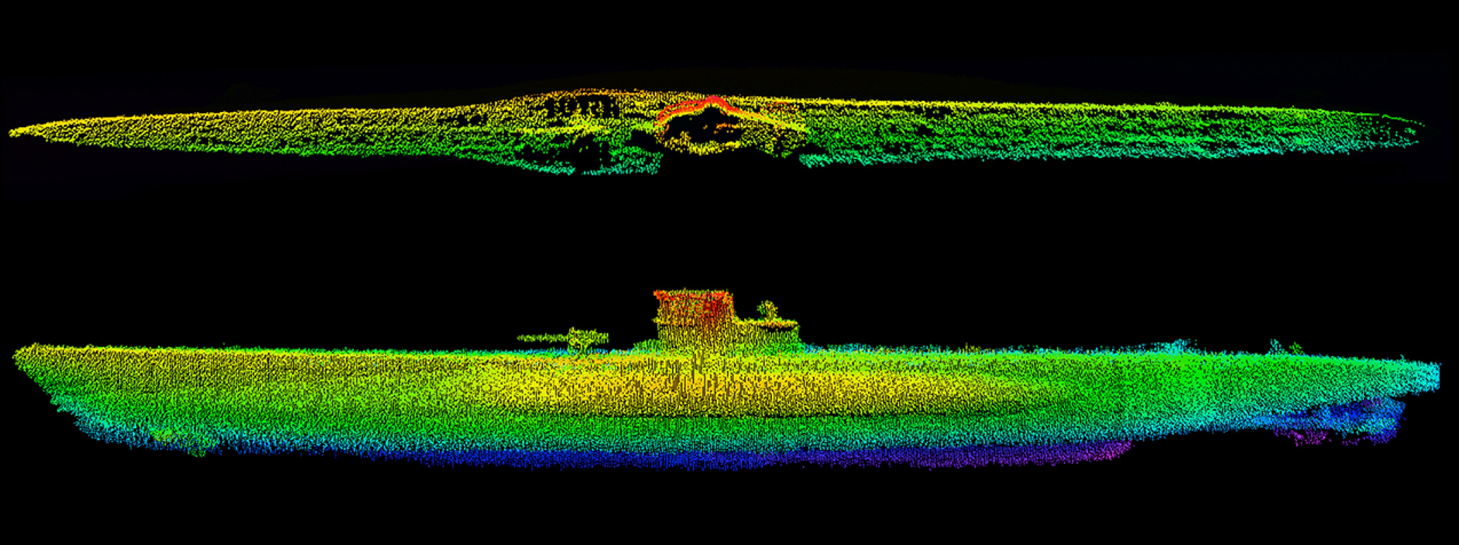
For the Bell Island Expedition, St. John supports the integration of imaging systems, survey technologies, and Digital Terrain Model (DTM) development for the documentation of the battlefield landscape.
Tim Joyce, B.A.
Royal Canadian Geographical Society
Cartography and Educational Outreach
Tim Joyce is associated with the Royal Canadian Geographical Society and supports the Bell Island Expedition through cartographic coordination, educational outreach, and public engagement initiatives. His work contributes to the development of mapping, educational resources, and geographic interpretation associated with the expedition.
Through the Royal Canadian Geographical Society and Canadian Geographic Education, Joyce assists with the communication of expedition results to national and international audiences. His involvement supports the integration of cartography, storytelling, and public education within the broader Battle of the Atlantic Virtual Memorial project.
For the Bell Island Expedition, Joyce supports geographic interpretation, educational development, and public-facing communication of the expedition’s historical and scientific results.
Guy Shockey, MA, BA (Hons), FRCGS
Dive Team Lead
Diving Operations
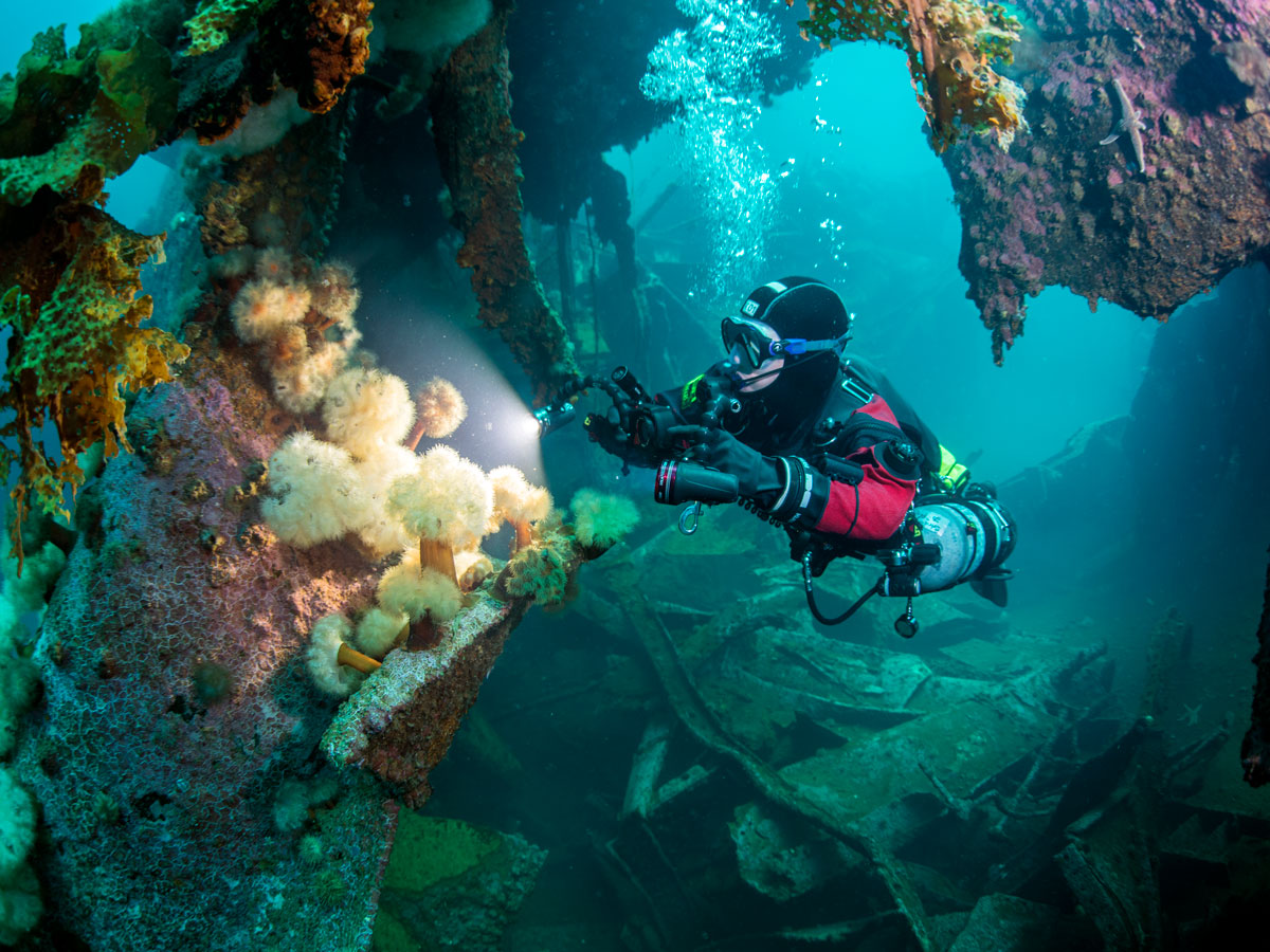
Guy Shockey is a Canadian technical diving instructor, expedition diver, and founder of Thermocline Diving. He is one of Canada’s most experienced technical divers and has participated in advanced wreck-diving, underwater archaeology, and expedition operations in deep-water and cold-water environments around the world.
Shockey has extensive experience in technical diving instruction, closed-circuit rebreather operations, and diver-based photogrammetry. He served as Dive Team Lead during the HMCS Canada Expedition 2025, coordinating deep technical diving operations associated with the three-dimensional documentation of Canada’s first purpose-built warship.
For the Bell Island Expedition, Shockey is responsible for technical diving operations, diver safety, underwater imaging coordination, and the management of in-water expedition activities.
Dr. Roger Lacasse, Ph.D., M.Sc., FRCGS
3D Photogrammetry Lead
Photogrammetry
Roger Lacasse is an accomplished technical diver with more than 900 dives across North America, the Caribbean, Europe, Asia, and Australia. A technical diver since 2002, he is trained in cave and trimix diving and specializes in underwater photogrammetry, three-dimensional modelling, and the documentation of maritime heritage sites.
Roger served as 3D Photogrammetry Lead for the HMCS Canada Expedition 2025, overseeing image acquisition and model development for the first complete three-dimensional photogrammetric documentation of HMCS Canada, Canada’s first purpose-built warship. The project produced a high-resolution digital model from thousands of underwater photographs and provided new archaeological and ecological management data for NOAA and marine heritage and ecological researchers.
For the Bell Island Battle of the Atlantic Virtual Memorial Expedition 2027, Roger serves as 3D Photogrammetry Lead, responsible for coordinating underwater imaging and photogrammetric documentation of the four Bell Island wrecks. Working with expedition partners, he will help develop detailed three-dimensional models that form a key component of the project’s integrated Digital Terrain Model and Virtual Memorial.
Madigan Jane Cotterill, MJ, FRCGS, FI’26
Expedition Lead
Social Media
Madigan Jane Cotterill is a Toronto-based journalist, photographer, editor, mountaineer and scuba diver focused on conservation and travel. She serves as Digital and Travel Editor at Canadian Geographic and Canadian Geographic Travel, whose print and digital publications reach four million readers monthly. As Social Media Editor for the Bell Island Expedition 2027, Madigan will communicate its ecological, archaeological and commemorative work to international audiences.
Madigan holds a Master of Journalism from Toronto Metropolitan University and a Bachelor of Arts from the University of Guelph, specializing in photography. Since 2018, she has contributed to several leading Canadian publications. Her global assignments include ecological projects in Japan, Argentina, Kenya and Zimbabwe.
In 2026, Madigan received two Travel Media Association of Canada honours: third place for Best Indigenous Tourism Experience in Canada for “Echoes in the Ice: Inuit Knowledge and the Changing Arctic,” and an honourable mention for Best Tourism for Positive Change Story for “Guiding Change: How Women Are Redefining Leadership on Kilimanjaro.” Drawing on her editorial judgement and visual storytelling experience, she will document the expedition’s progress, introduce its researchers and partners, and share the ecological, archaeological and historical stories preserved within Bell Island’s internationally significant Second World War underwater battlefield.
Marine Institute, Memorial University of Newfoundland

Principal Academic and Operational Partner
The Marine Institute of Memorial University of Newfoundland serves as the expedition’s principal academic and operational partner.
The Institute provides research-vessel support, technical expertise, and integration of marine science and survey technologies. With extensive experience in ocean research and applied marine technology in Atlantic Canadian waters, the Marine Institute enables the expedition to combine archaeological documentation, environmental study, and digital terrain mapping within a unified framework.
Kirk Regular and colleagues at the Marine Institute are supporting expedition planning, vessel operations, survey systems, and the integration of academic research with field documentation. The project will also provide opportunities for graduate student participation in fieldwork and data analysis.
Shipwreck Preservation Society of Newfoundland and Labrador
Heritage Partner
The Shipwreck Preservation Society of Newfoundland and Labrador contributes regional expertise, historical knowledge, and heritage stewardship.
The Society has long been involved in the documentation and protection of maritime heritage sites in Newfoundland waters and plays a key role in liaison with provincial authorities, local communities, and the diving community.
Neil Burgess and members of the Society provide historical research support, local operational knowledge, and coordination with heritage stakeholders, ensuring that all work aligns with established cultural heritage practices.
VOYIS

Underwater Imaging and Survey Technology
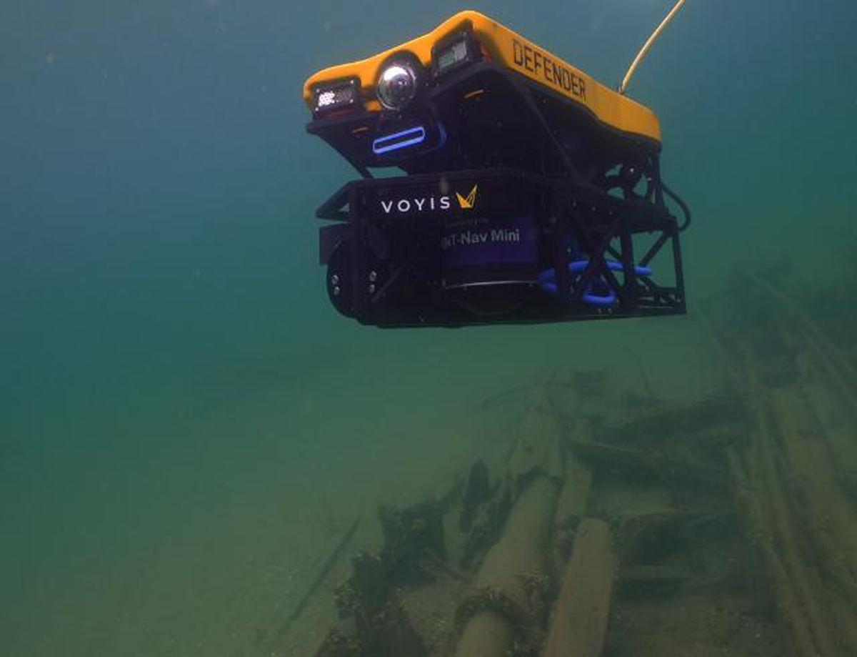
VOYIS provides advanced underwater imaging systems and technical expertise for three-dimensional photogrammetry and digital mapping.
Their technology enables high-resolution documentation of large-scale wreck sites in low-visibility, cold-water environments—conditions characteristic of Bell Island. This capability is central to the creation of an integrated Digital Terrain Model (DTM) of the battlefield.
Brenden St. John and the VOYIS engineering team support the expedition through imaging systems, survey integration, and on-site technical operations.
Royal Canadian Geographical Society (RCGS)

Expedition Partner
The Royal Canadian Geographical Society supports the expedition through its national expedition program, cartographic expertise, and educational outreach.
The Society has awarded the Bell Island Expedition a Major Grant and authorizes the expedition to fly the official RCGS Expedition Flag.
Tim Joyce and the Society’s cartographic and education teams assist with mapping, public outreach, and the development of educational material based on the expedition’s results.
Through Canadian Geographic and Canadian Geographic Education, the Society will help communicate the results of the expedition to national and international audiences.
Dive Team
The expedition dive team consists of highly experienced technical divers with backgrounds in deep-water, cold-water, and wreck-diving operations.
Team members have participated in underwater archaeology projects, scientific surveys, and expedition diving in challenging environments across multiple regions. Their work includes diver-based photogrammetry, mine-diving documentation, and operational support for remote survey systems.
Guy Shockey and members of the technical dive team are responsible for in-water imaging operations and ensuring that all diving activities are conducted safely, efficiently, and in accordance with non-intrusive archaeological protocols.
A Collaborative Expedition
The Bell Island Battle of the Atlantic Virtual Memorial Expedition is a volunteer-driven initiative supported by academic institutions, heritage organizations, marine-technology specialists, and experienced expedition personnel.
By integrating scientific research, historical investigation, and advanced imaging technology, the team contributes to a broader effort to document and interpret the Battle of the Atlantic—one of the longest and most strategically decisive campaigns of the Second World War.
While much of that conflict unfolded across vast ocean spaces, Bell Island represents a rare and intact coastal battlefield where multiple shipwrecks, defensive positions, and industrial infrastructure can be understood together as a single historical landscape.
Through this work, the expedition seeks not only to preserve the Bell Island site, but also to enhance public understanding of Canada’s role in the Battle of the Atlantic and the wider North Atlantic war.